
Have you ever been driving home from work, stuck in a traffic jam, wondering how the rest of the country deals with commuting? If so, you're in luck. Overflow Data has created a map that shows average commute times throughout the U.S.
They used compiled census data to help create the map. If you commute to work, you'll probably find that you don't have it too bad compared to other regions.
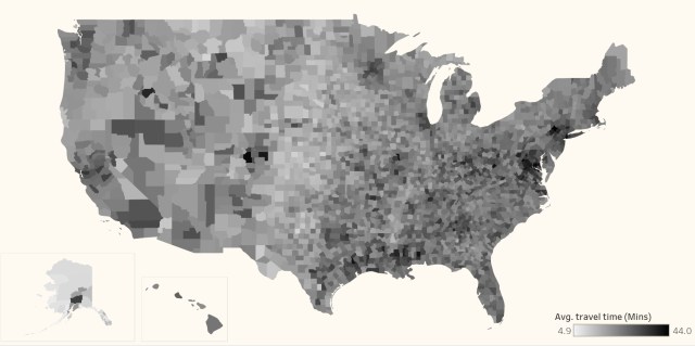
Commute times look to be the longest along the East Coast, where the majority of counties have a commute of around 30 minutes or more. The trend continues down the coast to the Southeastern states.
READ MORE: Map Shows Which U.S. Cities Have the Best and Worst Drivers
So, where are the shortest commutes in the country? They fall right in the middle of the U.S., where some only have to endure a 9-minute commute.
How does your commute fit in? You can compare your county to others all across the country over at Overflow Data.